
Epic 7-Day Northern California Road Trip Itinerary
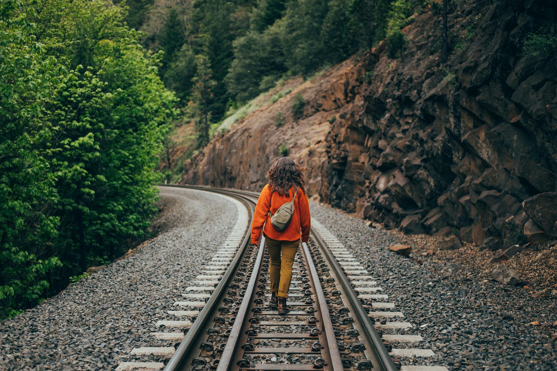
This 7-day road trip blends city sights, rugged coastlines, towering redwoods, historic towns, and mountain vistas into a loop that works year-round.
The itinerary is crafted for a reasonable pace – no marathon drives – making it enjoyable for travelers of all ages.
You’ll explore everything from San Francisco’s iconic bay views to the dramatic Big Sur cliffs, Yosemite’s granite peaks, tranquil Lake Tahoe, and the rolling vineyards of Napa Valley.
Optional detours and alternatives are noted for extra flexibility.
So pack your camera and sense of adventure – Northern California is ready to wow you!
Day 1: San Francisco – Golden Gate to City Gems
Start your journey in San Francisco, a vibrant city that’s a destination in itself.
Kick off the morning by visiting the Golden Gate Bridge, perhaps the city’s most famous landmark.
For a great view (and photo op), head to Baker Beach or the Marin Headlands across the bridge for a panoramic look at the 1.7-mile span and the bay.
You can even walk or bike a portion of the bridge’s pedestrian path to feel the breeze and take in the skyline.
After soaking up the bridge views, spend the afternoon exploring San Francisco’s lively streets.
Ride a classic cable car up and down the steep hills and wander through historic neighborhoods.
For example, hop off at Fisherman’s Wharf and Pier 39 – here you can watch sea lions lounging on the docks and grab a bite of clam chowder in a sourdough bowl.
From the wharf, it’s a short walk to Ghirardelli Square for some chocolate or to the Aquarium of the Bay if you’re traveling with kids.
In the evening, consider visiting Chinatown, the oldest Chinatown in North America, for dinner.
Stroll through the Dragon Gate and enjoy a meal (dim sum or noodles, anyone?) amid the colorful lanterns.
Alternatively, head to North Beach (Little Italy) for pizza or pasta on a sidewalk cafe.
If you have the energy, end the day with a sunset view from Twin Peaks or Coit Tower – both offer sparkling 360° vistas of the city lights.
After a full day of urban exploration, rest up; tomorrow you hit the road!
Day 2: Pacific Coast Highway – San Francisco to Big Sur
Say goodbye to the city and start south on the Pacific Coast Highway (Highway 1), one of America’s most scenic drives.
Today’s route takes you along the California coast to the legendary Big Sur region.
It’s not a huge distance (about 120 miles from SF to Big Sur proper), but you’ll want to allow plenty of time for stops and photos – this stretch is often called “the most beautiful and dramatic” part of the Pacific coast.
In the morning, drive about an hour south to Santa Cruz.
Here, you can stretch your legs at the Santa Cruz Beach Boardwalk, a vintage seaside amusement park operating since 1907 (the oldest in California).
It’s a great optional stop for some retro fun – maybe ride the Giant Dipper wooden roller coaster or enjoy a classic carousel ride.
Optional detour: If traveling with kids (or feeling young at heart), spend an hour at the Boardwalk for thrills and ocean views.
Continue south to Monterey, arriving around late morning or lunch.
Monterey is famous for its world-class Monterey Bay Aquarium and historic Cannery Row.
If you’re keen on marine life, the aquarium is a must-see (plan ~2 hours).
Otherwise, take a stroll along Fisherman’s Wharf to spot harbor seals and grab a seafood lunch.
Don’t miss driving through Pacific Grove and 17-Mile Drive (small toll) for a peek at the Lone Cypress and upscale Pebble Beach – this detour offers gorgeous coastal vistas and perhaps a chance to see deer or seals in their natural habitat.
Next, head to the charming village of Carmel-by-the-Sea just south of Monterey.
Carmel’s fairy-tale cottages and boutique shops invite a quick exploration.
From Carmel, Highway 1 enters Big Sur territory – 90 winding miles of cliffs, forests, and ocean spray.
As you drive, stop at Bixby Creek Bridge, an arch bridge high above the waves, for an essential photo.
Further south, pull over at Pfeiffer Big Sur State Park or Julia Pfeiffer Burns State Park to immerse yourself in nature.
A short walk at Julia Pfeiffer Burns leads to an overlook of McWay Falls, an 80-foot waterfall tumbling onto a picturesque beach.
Take your time along these twists and turns – every vista is stunning, with the Santa Lucia Mountains on one side and the endless Pacific on the other.
By evening, you’ll want to find a place to stay.
You could overnight in Big Sur itself (if you secured lodging or a campsite) to enjoy the serenity among redwoods, or backtrack a bit and stay in Monterey/Carmel where there are more accommodations.
Either way, the sunset on the coast is not to be missed – the sky often blazes orange and pink over the ocean.
Fall asleep to the sound of crashing waves if you’re near the shore, resting up for another adventure tomorrow.
Optional Stop: If time permits and the season is right (generally winter), stop by Point Lobos State Natural Reserve just south of Carmel. A short hike here can reward you with sightings of sea otters in the kelp beds and breathtaking coastal panoramas.
Day 3: Across California – Big Sur to Yosemite National Park
Trade the seascape for the mountainscape today. In the morning, depart the Big Sur/Monterey area and head inland towards Yosemite National Park.
It’s a significant drive (about 4–5 hours), so an early start is wise.
The journey will take you through California’s Central Valley, the agricultural heartland.
As you drive east, the landscape flattens into fields and orchards – keep an eye out for farm stands where you can grab fresh fruit or local nuts.
By midday, you’ll approach the Sierra Nevada foothills and the entrance to Yosemite.
The quickest year-round route is via Highway 140 through Mariposa and along the Merced River, which leads you right into Yosemite Valley.
(In summer, you could also enter via Highway 120 for a slightly shorter path, but any route into Yosemite promises great scenery.)
As you climb in elevation, pine forests thicken and granite cliffs begin to appear.
When you reach Yosemite Valley and pass through the final tunnel on Highway 41, prepare for a jaw-dropping view at Tunnel View: the sheer face of El Capitan on the left, majestic Half Dome far in the distance, and Bridalveil Fall flowing on the right – one of the classic panoramas of Yosemite.
Spend the afternoon exploring Yosemite Valley’s highlights.
Take the short walk to the base of Bridalveil Fall (in spring and early summer it roars, in autumn it’s a delicate wispy thread).
Cruise along the valley loop road and stop at El Capitan Meadow, where you can look straight up El Cap’s 3,000-foot vertical wall – you might even spot rock climbers as tiny specks on its face!
Another easy stop is Yosemite Falls, one of the tallest waterfalls in North America at 2,425 feet.
A flat one-mile loop takes you to the lower falls viewpoint, with mist on your face during peak flow.
In the late afternoon, check into your lodge or campsite.
Staying inside the park (if available) is ideal to maximize your time.
Options range from the historic Ahwahnee Hotel to simple canvas tent cabins at Half Dome Village (formerly Curry Village).
If lodging in the park wasn’t an option, towns like El Portal, Mariposa, or Oakhurst just outside the gates have accommodations.
As daylight fades, enjoy the peace of Yosemite.
On clear nights, the stars here are incredible – without city lights, you might see the Milky Way arcing overhead.
Get a good night’s sleep because tomorrow you’ll dive deeper into Yosemite’s wonders.
Optional Tip: Pick up some picnic supplies (sandwiches, snacks, water) before you enter Yosemite or at the valley market. Having a picnic by the Merced River with views of Half Dome is a memorable (and budget-friendly) way to dine in the park.
Day 4: Yosemite National Park – Valleys, Vistas, and Trails
Wake up in Yosemite National Park, surrounded by nature’s grandeur. Plan to spend most of today within the park, hitting a few must-see spots and maybe a short hike.
In the morning, the crowds are lighter and the wildlife more active – don’t be surprised if you spot deer in the meadows during an early stroll.
Consider driving (or taking the park shuttle, in season) to Glacier Point Road for an unparalleled vista.
At Glacier Point (accessible roughly late May–Oct, weather permitting), you’ll gaze down 3,000 feet to Yosemite Valley and across to Half Dome and an array of waterfalls.
It’s arguably the most famous view in the park.
If Glacier Point Road is closed (as it is in winter and early spring), an alternative is to hike to Columbia Rock or Vernal Fall footbridge from the valley – both are moderate hikes that offer rewarding views without needing all day.
The Mist Trail up to Vernal Fall is one iconic hike (a steep 1.5 miles one-way to the top of the waterfall), but even reaching the footbridge below the fall gives a great perspective of the thundering water in spring/early summer.
By midday, enjoy a picnic lunch at Cooks Meadow or Cathedral Beach.
Surrounded by towering granite and possibly the sight of climbers on El Capitan, it’s a lunch setting you won’t forget.
In the afternoon, you might visit the Yosemite Valley Visitor Center and the nearby Ansel Adams Gallery to learn about the park’s history and see famous photographs.
Another short, family-friendly walk is the Mirror Lake Trail (2 miles round trip) which leads to a small lake (seasonal) with reflections of Half Dome – a nice leg-stretcher and kid favorite.
As the afternoon progresses, it’s time to bid farewell to Yosemite and continue your road trip.
Depart the park via the Tioga Pass Road (Highway 120) if the season allows – this scenic high country route cuts directly east through the Sierra Nevada.
You’ll pass by turquoise Tenaya Lake and the sweeping alpine meadows of Tuolumne Meadows at 8,600 feet elevation.
Keep an eye out for marmots sunning on the rocks and perhaps stop at Olmsted Point for a sideways view of Half Dome from afar.
Exiting the park at Tioga Pass (nearly 10,000 feet high), you immediately enter a different world on the east side of the range.
Consider a quick stop at Mono Lake near the town of Lee Vining. Mono Lake is a saline lake famed for its bizarre tufa tower rock formations sticking up from the water’s surface – a great spot for surreal photos.
Important: If you’re traveling in winter (approximately November through May), Tioga Pass is closed due to snow.
In that case, you’ll exit Yosemite the way you came (west) and loop north around the mountains.
An alternate winter route is to drive west to Oakdale or Sacramento and then head northeast toward Lake Tahoe.
This adds driving time (winter Day 4 will be a longer drive), but it’s the safest way when mountain passes are snowed in.
Either way, aim to reach the Lake Tahoe area by the evening of Day 4.
It’s a drive of about 4 hours via Tioga Pass to Tahoe’s south shore (or roughly 6–7 hours via the winter route through the Central Valley), so arriving by dinner is doable if you left Yosemite by early afternoon.
Upon arriving in South Lake Tahoe (the most bustling town on the lake, straddling the California–Nevada border), settle in for the night.
You’ve earned a relaxing evening after the day’s travels.
Perhaps unwind at your hotel’s hot tub or take a short walk to the lake shore – if the night is clear and you’re up for it, the stars reflecting on Lake Tahoe are magical.
Tomorrow you’ll have time to enjoy Tahoe’s beauty in daylight.
Optional Stop (Summer route): On the Tioga Road route, you can detour to Bodie State Historic Park, a fascinating Gold Rush-era ghost town (accessible via a side road off HWY 395 north of Lee Vining). It’s a bit off the main path and adds time, but history buffs would enjoy the preserved 19th-century buildings in this Wild West ghost town.
Optional Stop (Winter route): If you detour through Gold Country on Highway 49 north, consider a stop in a historic mining town like Placerville or Jackson. For example, Placerville (off Highway 50 on the way to Tahoe) is a charming town that got its name during the Gold Rush when placer gold was found in its rivers in the 1840s. Its Main Street still reflects that 19th-century character, and it’s a nice place to grab a warm meal or stretch your legs.
Day 5: Lake Tahoe – Blue Water and Mountain Air
Wake up to the fresh alpine air of Lake Tahoe, the largest alpine lake in North America.
The lake’s striking clarity and deep blue color will take your breath away – in some spots you can see down over 70 feet into the water!
Take the morning to enjoy Tahoe’s natural beauty and recreational options.
Start with a drive to Emerald Bay State Park on the southwest side of the lake, about 20–30 minutes from South Lake Tahoe.
Emerald Bay is famous for its postcard-perfect Emerald Bay Viewpoint, where you can see the tiny Fannette Island in the middle of the bay and the 1920s Scandinavian-style Vikingsholm castle on the shore.
This overlook is especially stunning in the morning light.
There’s a short trail down to Vikingsholm if you’d like a closer look at the castle and the lake (just remember the walk back up is a bit steep).
Another quick hike option here is the trail to Eagle Falls, which is a relatively easy walk to a cascading waterfall with lovely views of Emerald Bay (trailhead is right by the Emerald Bay overlook parking).
After soaking in Tahoe’s beauty, you might indulge in some activity.
In summer months, popular options include swimming or kayaking in the clear waters (Sand Harbor on the Nevada side is a great beach for swimming), paddleboarding, or even taking a boat cruise across the lake.
If you’re visiting in winter, Tahoe is a skiing paradise – resorts like Heavenly (in South Lake Tahoe) or Northstar offer slopes for all levels, and even non-skiers can take Heavenly’s scenic gondola ride up for panoramic views.
With 300 days of sunshine a year in Tahoe, chances are good you’ll have fair weather whether you’re building a sandcastle or a snowman!
By late morning or midday, begin the drive westward toward Napa Valley.
The route from Tahoe to Napa is roughly 3.5–4 hours (about 200 miles).
You’ll descend from the mountains and cross the flat Sacramento Valley.
If you didn’t stop in Sacramento before, you have the option now – the state capital has attractions like the historic Old Sacramento waterfront (with wooden sidewalks and Wild West storefronts) or the California State Railroad Museum which kids love.
Otherwise, continue on through the farm country and watch the landscape change to gentle hills as you approach Napa Valley.
Aim to arrive in the Napa/Sonoma wine country by late afternoon.
The road will lead you through vineyards and quaint towns as you enter Napa Valley, which is world-renowned for its wines.
Napa Valley is approximately 30 miles long and filled with more than 400 wineries ranging from ornate castles to small family farms.
Even if wine isn’t your main interest, the scenery and experience here are delightful.
Before dinner, you might have time to squeeze in a wine tasting at a winery’s tasting room or an early evening vineyard tour.
(Many wineries close by 5pm, so keep an eye on the time.)
For a family-friendly twist, consider riding the Napa Valley Wine Train (if you arrived early enough for the evening excursion) – it’s a relaxing scenic ride in vintage rail cars, offering dinner and wine for adults and a unique experience for kids.
Another popular activity (for any age) is a hot air balloon ride at sunset, floating gently above the vineyard-draped valleys.
If that’s too ambitious for today, you can plan it for tomorrow morning instead (balloon rides often launch at sunrise).
Tonight, enjoy a well-earned meal. Downtown Napa city has a range of restaurants, or you could dine in the charming town of Yountville, known for its culinary scene (from fancy Michelin-star spots to casual eateries).
Rest in a cozy B&B or hotel amid the vineyards. Tomorrow you’ll delve deeper into wine country delights.
Optional Stop: On the drive from Tahoe, if you have extra time, detour to Old Sacramento. The Old West ambiance, complete with horse-drawn carriages and railroad history, offers a nice contrast before you enter modern wine country. The Sacramento waterfront also has plenty of casual dining if you want to break up the drive with lunch.
Day 6: Napa and Sonoma – Wine Country Wanderings
Begin your morning in Napa Valley when the air is cool and the vineyards are draped in dew.
You might drive up the valley to St. Helena or Calistoga, enjoying views of neatly trellised grapevines and rolling hills.
Stop by Castello di Amorosa (a replica medieval castle winery) for a fun and scenic tour, or Sterling Vineyards where an aerial tram carries you up to the winery with panoramic views.
Many wineries open around 10am for tours and tastings – pick one or two that fit your interest (some require reservations).
If wine tasting isn’t ideal for your group, don’t worry – the area has other attractions.
In Calistoga, you can visit the curious Old Faithful Geyser of California, which erupts hot water every 30 minutes or so, or the nearby Petrified Forest where giant redwood trees turned to stone long ago.
By midday, consider crossing over to Sonoma County for a change of pace.
Sonoma is adjacent to Napa and known for a more laid-back vibe.
Drive west over the scenic Oakville Grade or Trinity Road into Sonoma Valley (the drive is about 45 minutes from Napa to Sonoma town).
In the town of Sonoma, visit the historic Sonoma Plaza – a large tree-lined square ringed by adobe buildings, including the Mission San Francisco Solano (Sonoma’s 19th-century Spanish mission) and charming shops and cafes.
This is a perfect spot to enjoy a picnic lunch or taste some local cheeses. Sonoma was once the heart of California’s wine industry and still boasts excellent wineries (plus plenty of tasting rooms right around the plaza if you’d like to sample Sonoma wines without further driving).
For the afternoon, you have options: wine aficionados might tour another winery in Sonoma Valley (for example, Jacuzzi Family Vineyards offers free tastings and has olive oil tasting too, or Buena Vista Winery, one of California’s oldest, for a bit of history).
If you’ve had your fill of wineries, you could instead take a short drive into the town of Healdsburg in northern Sonoma County – a foodie haven with a lovely town square and boutiques.
Another alternative is driving out to Sonoma Coast State Beach (about an hour from Sonoma town) to feel the Pacific breeze again at Bodega Bay, if you crave one more ocean vista.
As the day winds down, treat yourself to a delicious dinner.
Perhaps try a farm-to-table restaurant in downtown Napa or a cozy Sonoma bistro.
Both valleys are renowned for their cuisine, often using fresh local ingredients.
You really can’t go wrong with the menus here – whether you crave artisanal pizza, gourmet California cuisine, or just a great burger, you’ll find it.
And of course, local wine to toast your trip!
Spend one more night in the Napa/Sonoma area, relishing the countryside tranquility.
Tomorrow, the journey comes full circle back to San Francisco, with one last natural wonder on the way.
Optional Activity: Not into wine? Napa/Sonoma offers other fun experiences. For example, start your day with a hot air balloon ride at dawn, floating above the vineyards (an unforgettable sight as the sun rises). Or, visit Safari West in Santa Rosa – a 400-acre wildlife preserve where you can take a jeep tour to see giraffes, zebras, and more.
Day 7: Among Giants – Redwoods and Return to San Francisco
It’s the final day, but we’ve saved a truly special stop for last.
Today you’ll travel from Wine Country back to San Francisco, with a detour to walk among the ancient redwood forests that Northern California is famous for. Pack up in Napa and head south towards the Bay Area.
Instead of taking the direct route to the city, drive west towards Marin County across the Coastal Range.
In about an hour, you’ll reach Muir Woods National Monument, a sanctuary of old-growth coast redwood trees just north of San Francisco.
(Be sure to reserve parking or a shuttle in advance, as Muir Woods requires it to manage crowds.)
At Muir Woods, step into a primeval forest that feels worlds away from any city.
A level boardwalk trail follows Redwood Creek into the grove, where you’ll be surrounded by towering redwoods that soar over 250 feet high.
These are some of the tallest trees on Earth – coast redwoods can grow to about 350 feet tall over centuries.
As you walk the shaded path, sunlight filters through the lush canopy high above, and the air smells of fresh moss and earth.
It’s quiet except for the babbling of the creek and chirping of birds.
You can choose a short loop (the main trail loop is a easy 1-2 miles) or a longer hike if you’re feeling energetic (like the Bohemian Grove or Cathedral Grove trails, which offer some of the most impressive trees).
Take your time – this is a chance to reflect on the week’s journey amidst nature’s cathedral of redwoods.
After experiencing Muir Woods, you’ll drive the final leg back to San Francisco. It’s only about 30 minutes from Muir Woods to the Golden Gate Bridge.
As you approach the bridge from the Marin side, consider stopping at the Golden Gate Bridge Vista Point (right before the bridge) or up on Conzelman Road in the Marin Headlands for a last sweeping view of San Francisco Bay.
It’s a fantastic bookend to the trip – the city skyline and the orange towers of the Golden Gate come into view, often with sailboats dotting the bay and maybe the fog rolling in.
Cross the Golden Gate Bridge and you’re back in San Francisco where it all began!
Depending on your schedule, you could spend the afternoon picking up any sights you missed at the start (there’s always more to see in SF – Golden Gate Park, Alcatraz Island, or the Ferry Building Marketplace are a few favorites).
Otherwise, congratulate yourself on completing an incredible loop of Northern California.
In one week, you’ve driven from the ocean to the mountains, through forests and vineyards, and back to the bay, covering many of the Golden State’s most beautiful landscapes.
Before you go, grab a farewell dinner in San Francisco – perhaps some delicious Dim Sum, Mexican food in the Mission District, or fresh Dungeness crab if it’s in season (San Francisco is known for its seafood).
As you reminisce about the towering redwoods, the crashing Big Sur waves, and the granite giants of Yosemite, you’ll surely agree: Northern California is truly a land of diverse wonders.
Trip Tip: The loop can be done in reverse or modified depending on flight plans. San Francisco is the common start/end, but you could also begin in another city like Sacramento or San Jose if it suits your plans better.
The itinerary works year-round, but always check road conditions (especially mountain passes in winter) and make necessary reservations (Yosemite lodging, Muir Woods parking, etc.) well in advance.
Optional Additions and Alternatives
Avenue of the Giants (Redwoods Up North)
If you have more time or want to see the truly massive redwoods farther north, consider extending your trip to Humboldt Redwoods State Park.
About four hours north of San Francisco lies the Avenue of the Giants, a 31-mile scenic drive that winds through an old-growth redwood forest.
Here, trees over 1,000 years old and 300 feet tall tower above the road – it’s a humbling experience.
You could fit this in by adding a couple of days: for example, drive from San Francisco up Highway 101 to Avenue of the Giants, then over to wine country and continue the itinerary.
Or, do it at the end of Day 7 (though it would be a long haul) and return to SF via the coast.
This northern detour also opens up the chance to see Redwood National Park near the Oregon border if you have even more days to spare.
Mount Shasta and Lassen Route
As an alternative to Lake Tahoe, a more northerly loop could take you from Yosemite up toward Mount Shasta.
This 14,180-foot volcano offers hiking and beautiful alpine lakes in its shadow.
Nearby Lassen Volcanic National Park is another hidden gem with bubbling mud pots and volcanic landscapes.
From Yosemite, you’d drive up through the northern Central Valley to Redding and Mt. Shasta (about 5–6 hours).
After exploring Shasta, you could head west to the coast to see the redwoods, then south through wine country back to SF.
This option would replace the Tahoe segment and likely add a couple of days, but it’s a fantastic route for those interested in volcanoes and more remote forests.
Extra Day in San Francisco or Tahoe
If you prefer a slower pace, you might trim the itinerary to focus on fewer destinations.
For instance, spend an extra day in San Francisco at the start (to fully experience museums, neighborhoods, and maybe a ferry to Alcatraz Island), or allocate two nights in Lake Tahoe to both relax on the beach and hit the mountain trails.
There’s plenty to do in each major stop – a road trip is about personalizing the journey to your interests.
Happy travels, and enjoy the Golden State!